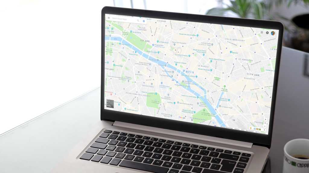
Google Maps offers a powerful yet often overlooked feature called Travel Time. This tool allows you to visualize the reachable area within a specified time limit, either by driving or walking. Currently available only on the web version of Google Maps, Travel Time provides a unique perspective on distance and accessibility. This article explores how to activate and utilize this valuable feature, along with its limitations and potential applications.
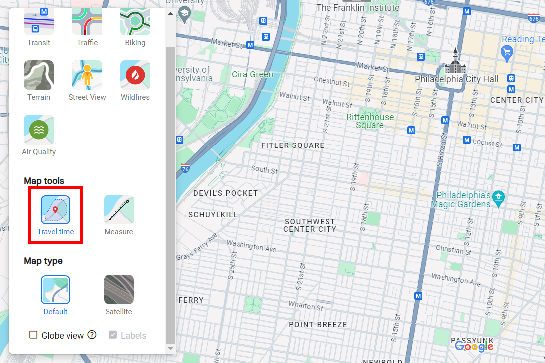 Google Maps screenshot highlighting Travel Time feature Joel Lee / IDG
Activating Travel Time on Google Maps
Accessing Travel Time is straightforward. Open maps.google.com in your web browser. A Google account isn’t required. Locate the “Layers” icon in the bottom-left corner and hover over it to reveal a menu. Select “More,” then under “Map Tools,” click “Travel Time.”
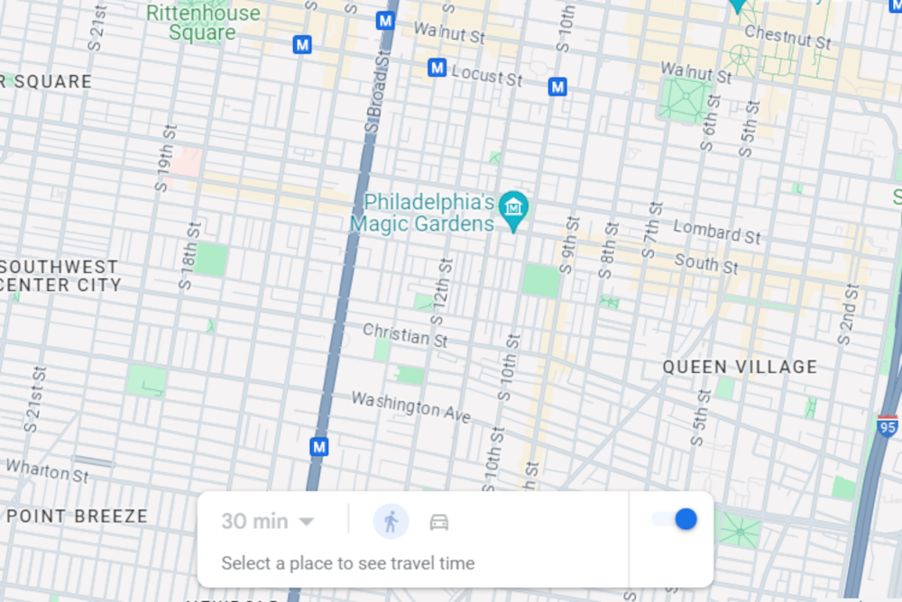 Google Maps screenshot showing Travel Time feature enabled Joel Lee / IDG
A new panel will appear at the bottom-center of the map, displaying initially grayed-out time limit and travel method options. Click anywhere on the map to establish your starting point. Once set, the travel method and time limit options will become active.
Utilizing the Travel Time Feature
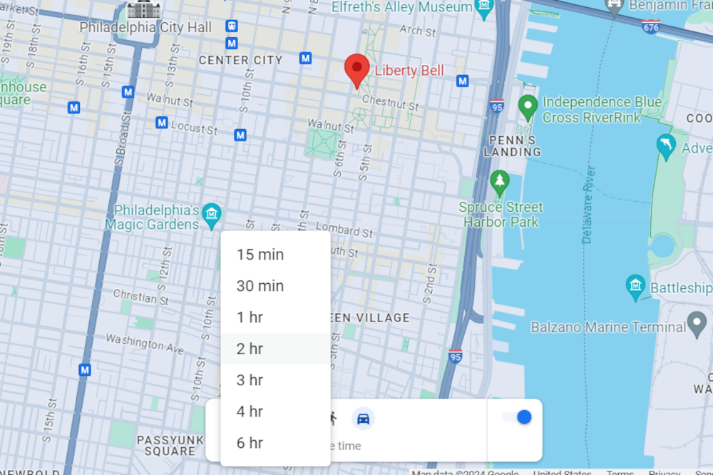 Google Maps screenshot showing Travel Time duration options Joel Lee / IDG
For walking, you can select 15 or 30 minutes. Driving offers more choices: 15, 30 minutes, and 1, 2, 3, 4, or 6 hours.
Upon selecting your parameters, a shaded area will appear on the map, representing the reachable region within the chosen time frame. The shape of this shaded area may be irregular, reflecting variations in road networks and potential obstacles.
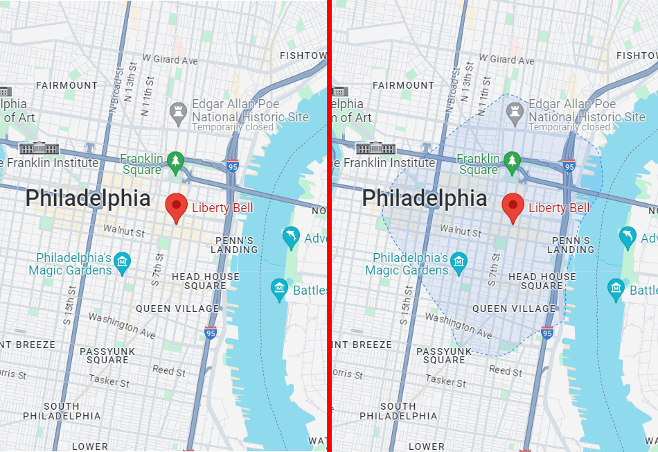 Google Maps screenshot showing Travel Time on and off comparison Joel Lee / IDG
For larger time limits, you may need to zoom out to view the entire shaded area.
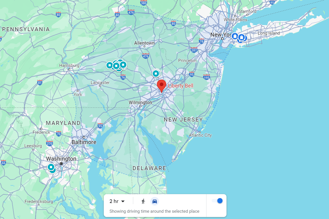 Google Maps screenshot with Travel Time at two hours driving Joel Lee / IDG
Limitations of Travel Time
Despite its usefulness, Travel Time has some limitations. Currently, it doesn’t account for real-time traffic conditions, providing only a general estimate. This can lead to inaccuracies during peak hours or unexpected traffic incidents. Additionally, Travel Time data isn’t universally available; some locations may lack walking data, or data altogether.
Conclusion
While not perfect, Google Maps’ Travel Time feature provides a valuable tool for visualizing reachable areas within specific timeframes. Its ability to estimate travel distance based on time constraints can be useful for planning trips, exploring new areas, or simply understanding geographic accessibility. While current limitations regarding traffic and data availability exist, the feature remains a practical addition to Google Maps’ suite of tools.

