The Caucasus mountains hold secrets of ancient civilizations, and recent archaeological discoveries have shed light on a remarkable Bronze Age fortress. Initially perceived as a modest site, Dmanisis Gora in southern Georgia has been revealed as a sprawling complex, exponentially larger than previously imagined, thanks to innovative drone technology. This groundbreaking research, published in Antiquity, offers valuable insights into the urbanization and growth patterns of ancient settlements globally.
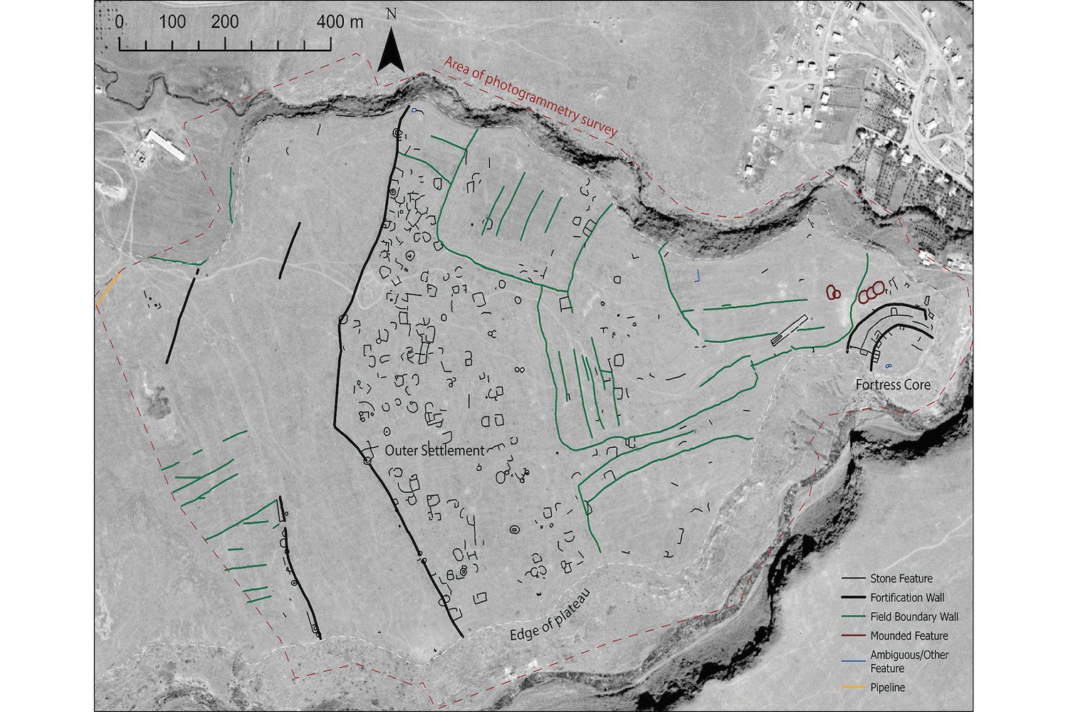
Dmanisis Gora, initially surveyed amidst tall summer grass, concealed its true scale until the autumnal landscape revealed extensive fortification walls and stone structures beyond the initially identified inner fortress. Recognizing the limitations of ground-based observation, the research team, comprising experts from the UK, Georgia, and the US, turned to drone technology.
The team, led by Nathaniel Erb-Satullo of the Cranfield Forensic Institute and Dimitri Jachvliani of the Georgian National Museum, began investigating Dmanisis Gora in 2018. After initial excavations, the realization that the site extended far beyond initial estimates prompted the use of drone technology. This aerial perspective proved revolutionary, revealing the true magnitude of the ancient fortress.
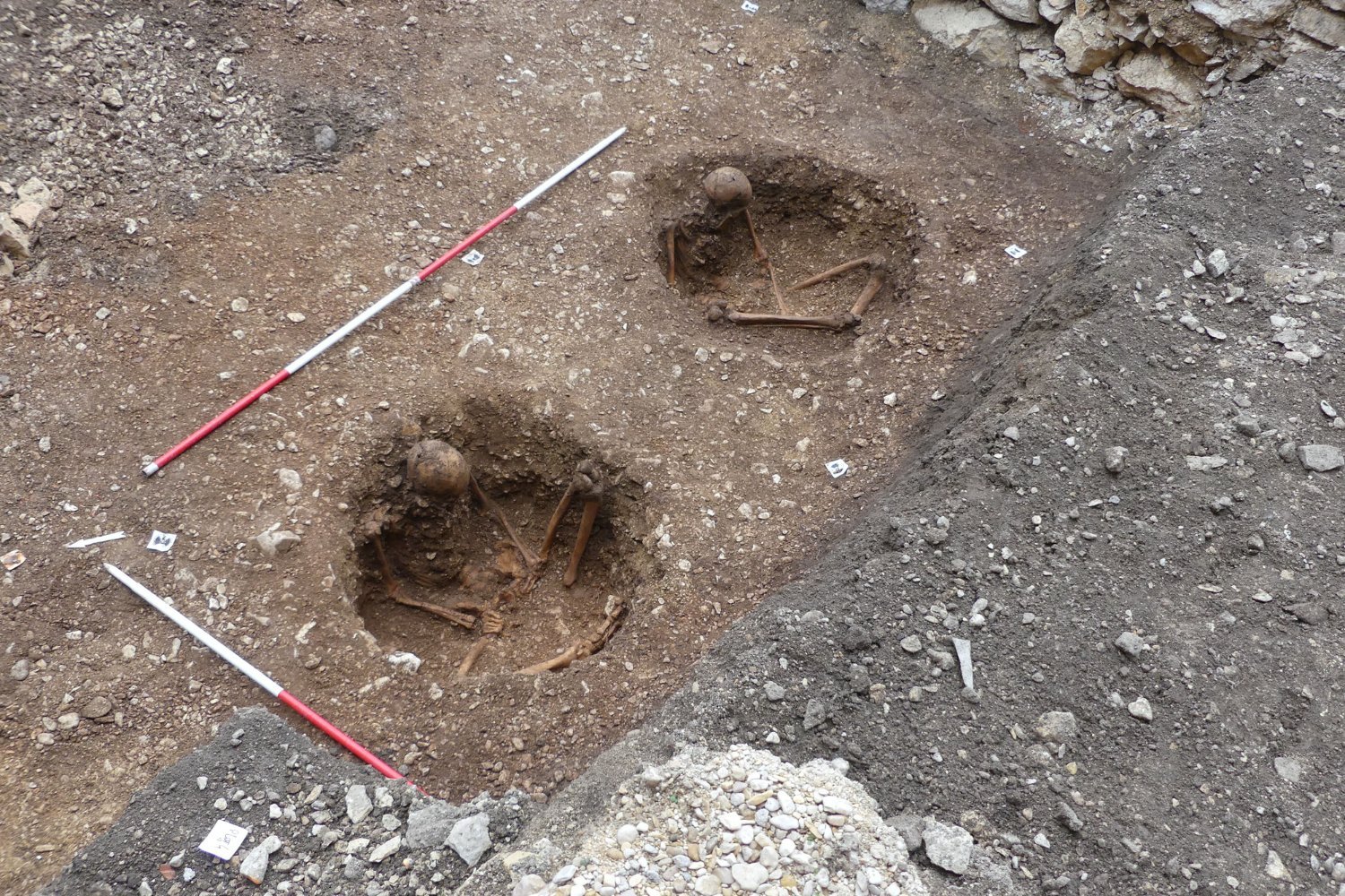
Nearly 11,000 aerial photographs captured by the drone were meticulously stitched together to create detailed digital elevation models and orthophotos. Orthophotos, corrected for distortions like camera angle, provided a highly accurate representation of the site. This data unveiled subtle topographic features, mapping fortification walls, graves, field systems, and other stone structures within the outer settlement.
The results were astonishing. The survey revealed Dmanisis Gora to be over 40 times larger than initially estimated, encompassing a vast outer settlement protected by a kilometer-long (approximately 0.62 miles) fortification wall. This discovery redefines the site’s significance not only for the Southern Caucasus region but also for understanding the diversity and formation processes of large-scale ancient settlements worldwide.
To further understand the evolution of the site, researchers compared the drone-generated orthophotos with declassified Cold War-era spy satellite imagery from 2013. This comparison highlighted the impact of modern agriculture’s encroachment on the ancient fortress.
While modern expansion poses a threat to Dmanisis Gora’s preservation, the researchers believe its ancient growth was likely driven by interactions with nomadic pastoral groups. They hypothesize that the outer settlement may have fluctuated in size seasonally, accommodating shifting populations and resources.
The team now plans to utilize the collected data to delve deeper into aspects like population density, livestock movements, and agricultural practices. This research promises to reveal further details about life within Dmanisis Gora and the broader context of Late Bronze Age and Early Iron Age societies.
The drone mapping of Dmanisis Gora not only illuminates this specific mega-fortress but also contributes to our understanding of ancient urbanization patterns. This study exemplifies the power of combining modern technology with historical data, even utilizing declassified spy satellite imagery, to unlock the secrets of the past. It provides invaluable insight into the complex dynamics of ancient societies and their interaction with their environment.

