Imagine uncovering the location of a pivotal historical battle hidden in plain sight. An international team of archaeologists has achieved just that, using declassified spy satellite images to pinpoint the likely site of the Battle of al-Qadisiyyah, a crucial early Islamic conflict that reshaped Persian history.
This groundbreaking discovery provides a geographical context for a battle central to the expansion of Islam into modern-day Iraq, Iran, and beyond. The team from Durham University and the University of Al-Qadisiyah in Iraq employed an interdisciplinary approach, combining historical texts, modern aerial photos, on-the-ground evidence, and declassified 1970s American spy satellite imagery. Their findings were recently published in the journal Antiquity.
Uncovering a Lost Battlefield
The Battle of al-Qadisiyyah, fought between Arab Muslims and the Sasanian Empire in the 630s CE, paved the way for the Islamic conquest of Mesopotamia, Persia, and beyond. However, the exact location of this significant battle remained a mystery until now.
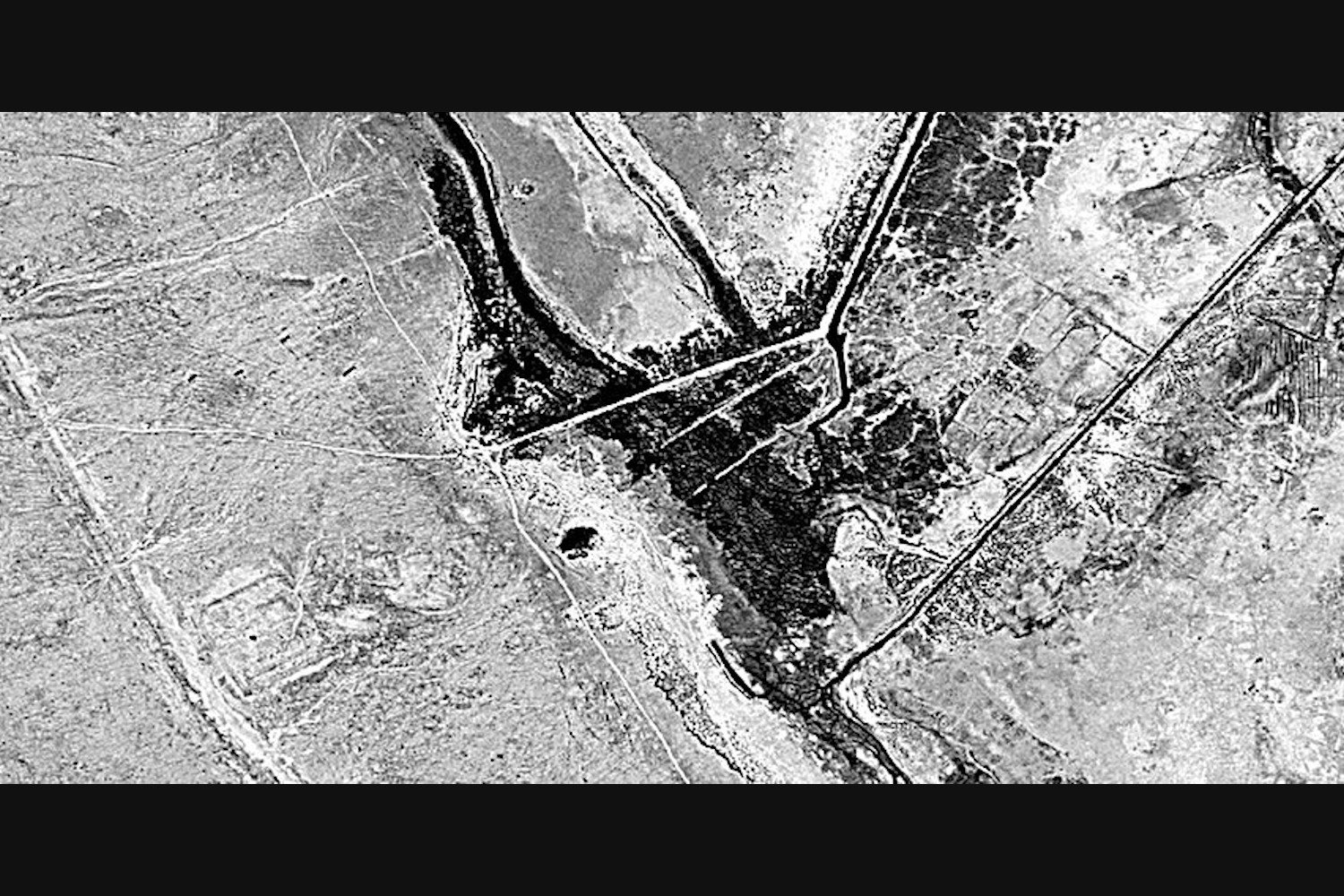
The discovery came during a remote survey of the Darb Zubaydah, a historic pilgrimage route between Kufa, Iraq, and Mecca, Saudi Arabia. Using aerial imagery from Google Earth and Bing Maps, the researchers identified a distinctive 6.2-mile (10-kilometer) double-walled feature situated between a square fortress on the desert edge and a large settlement bordering the southern Mesopotamian floodplain. Declassified U.S. spy satellite images from 1973 corroborated these findings, offering a clearer view of the area before modern agricultural and urban development obscured the landscape. Archaeologists from the University of Al-Qadisiyah conducted an on-the-ground survey to further document the features.
Matching Archaeological Evidence with Historical Texts
By comparing their archaeological observations with descriptions in 9th, 10th, and 14th-century CE texts detailing the Battle of al-Qadisiyyah, the researchers concluded that the fortress and settlement might represent two previously unidentified waystations along the Darb Zubaydah: al-’Udhayb and al-Qadisiyyah, respectively. The remarkable agreement between textual references and archaeological evidence from aerial imagery strengthens this hypothesis.
A 10th-century text provides a detailed description of the battle’s location, placing it between a trench and a now-dry river near the settlement of al-Qadisiyyah, approximately 18.6 miles (30 kilometers) south of Kufa.
A Unique Perspective Reveals History
This research demonstrates the power of combining diverse data sources, including declassified spy satellite imagery, to unlock historical secrets. The discovery of the likely location of the Battle of al-Qadisiyyah offers valuable insights into a pivotal moment in history, illuminating the early expansion of Islam and its impact on the region.
Conclusion
The use of declassified spy satellite imagery has proven instrumental in locating the probable site of the historic Battle of al-Qadisiyyah. This interdisciplinary research, combining archaeological evidence with historical texts and modern technology, provides a clearer understanding of this crucial event in early Islamic history. This discovery underscores the potential of remote sensing and archival research to reveal hidden historical landscapes and shed light on significant moments in human history.
