Vikings, the renowned Scandinavian seafarers, dominated Northern European waters between 800 and 1050 CE, establishing vast trade and settlement networks. However, the specifics of their maritime routes, particularly the crucial stopover points, remain largely unknown. A new study, leveraging experimental archaeology, aims to illuminate these forgotten Viking sea havens by literally sailing in their wake.
Charting the Unseen: The Quest for Viking Pit Stops
While major Viking ports like Bergen, Dublin, and Ribe are well-documented, the journeys connecting them are less understood. Lund University archaeologist Greer Jarrett embarked on a unique project to reconstruct these seafaring itineraries. [internal_links] “My hypothesis is that this decentralised network of ports, located on small islands and peninsulas, was central to making trade efficient during the Viking Age,” Jarrett explained in a statement. He believes these smaller havens were vital for Viking Age trade and travel along the Norwegian coast.
Sailing Through History: The Experimental Voyages
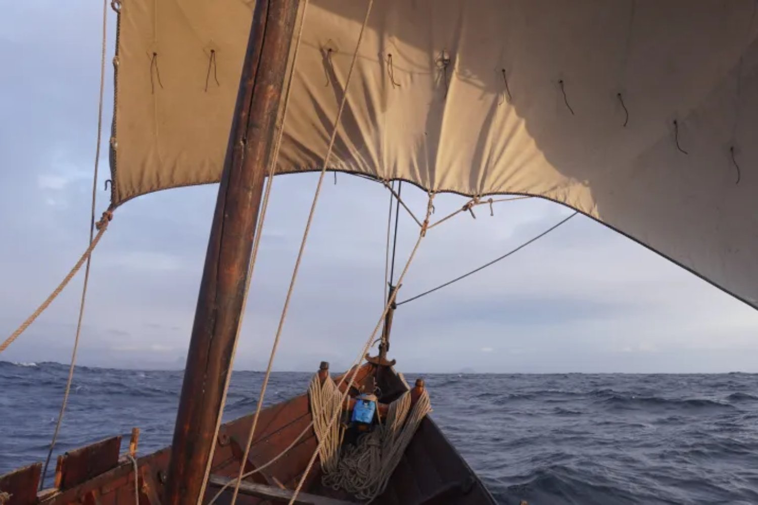
Between September 2021 and July 2022, Jarrett and his team conducted 15 sailing trials and two extended voyages, spanning nearly 1,500 nautical miles. They utilized seven different traditional Nordic clinker boats—small, open wooden sailboats with a design history stretching back almost two millennia. The voyages weren’t without challenges; a snapped mast pole over 15 miles (25 kilometers) offshore underscored the realities faced by ancient mariners, forcing an improvised repair with lashed oars to secure the sail and return to land.
Defining a Viking Haven: Criteria for Long-Range Voyages
Jarrett’s search for potential Viking havens, specifically for long-range expeditions rather than raiding voyages, was guided by specific criteria. These locations needed to offer fresh water, protection from wind and swells, and a clear view of the sea. Accessibility in low visibility, capacity for multiple vessels, approachability from various directions, and a position in coastal “transition zones” between exposed seas and inner archipelagos were also key. This practical knowledge was combined with digital reconstructions of Viking Age sea levels and historical data on 19th and early 20th-century sailing routes used by fishermen and sailors.
New Perspectives on Ancient Seafaring
This hands-on approach, detailed in the study published in the Journal of Archaeological Method and Theory, emphasizes practical seafaring experience. Jarrett argues it seeks “to counter the common academic bias towards terrestrial and textual sources and worldviews.” [internal_links] Through this methodology, he identified four potential Viking havens along the Norwegian coast. These sites show varying degrees of prior archaeological evidence of human activity, but their role as Viking maritime pit stops is a new proposition based on these experimental voyages. Jarrett emphasizes that this “list of possible Viking Age havens…is intended as a working document, which can shape and be shaped by future archaeological surveys and excavations.”
Jarrett’s list of possible Viking Age havens is a “working document,” intended to guide future archaeological investigations. While experimental voyages cannot replace direct archaeological evidence of Viking activity, this creative and practical approach offers valuable new insights. It highlights how stepping into the past, quite literally, can reshape our understanding of ancient maritime networks and inspire further exploration.


